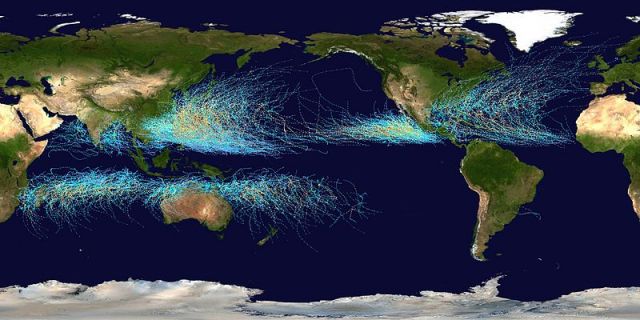
 Tropical cyclone tracks worldwide, 1985 to 2005. Points show locations of storms at 6-hour intervals. Credit: Nilfanion via Wikimedia Commons.
The North Atlantic may feel like the epicenter of tropical cyclone activity, but it’s not, since it generates an average of only 10 named storms a year compared to 36 in the North Pacific. If you really want to escape the clutches of these monsters, the place to be is the South Atlantic. As you can see from this composite tracks map, the South Atlantic generated only one tropical cyclone in the 20 years between 1985-2005. Why the tranquility? Well, it’s less a factor of colder ocean temperatures than strong vertical wind shear, which shreds big systems before they can form. Plus the the South Atlantic typically has no intertropical convergence zone (the Doldrums, in sailor speak) to drive large scale spin and thunderstorm activity.


