Water is life. It’s also big business. In our November + December 2023 issue, Mother Jones dives into the West’s deepening water crisis—and the forces behind it, from historic drought to short-sighted policies to corrupt lawmakers and the special interests they serve. Read the full package here.
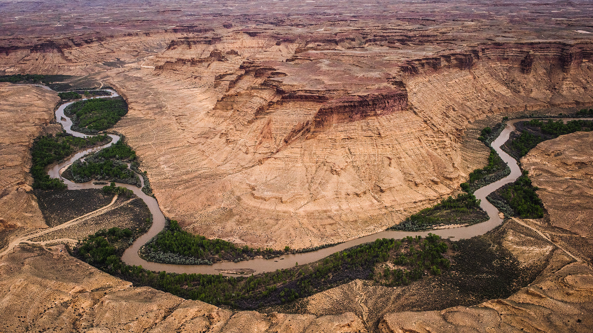
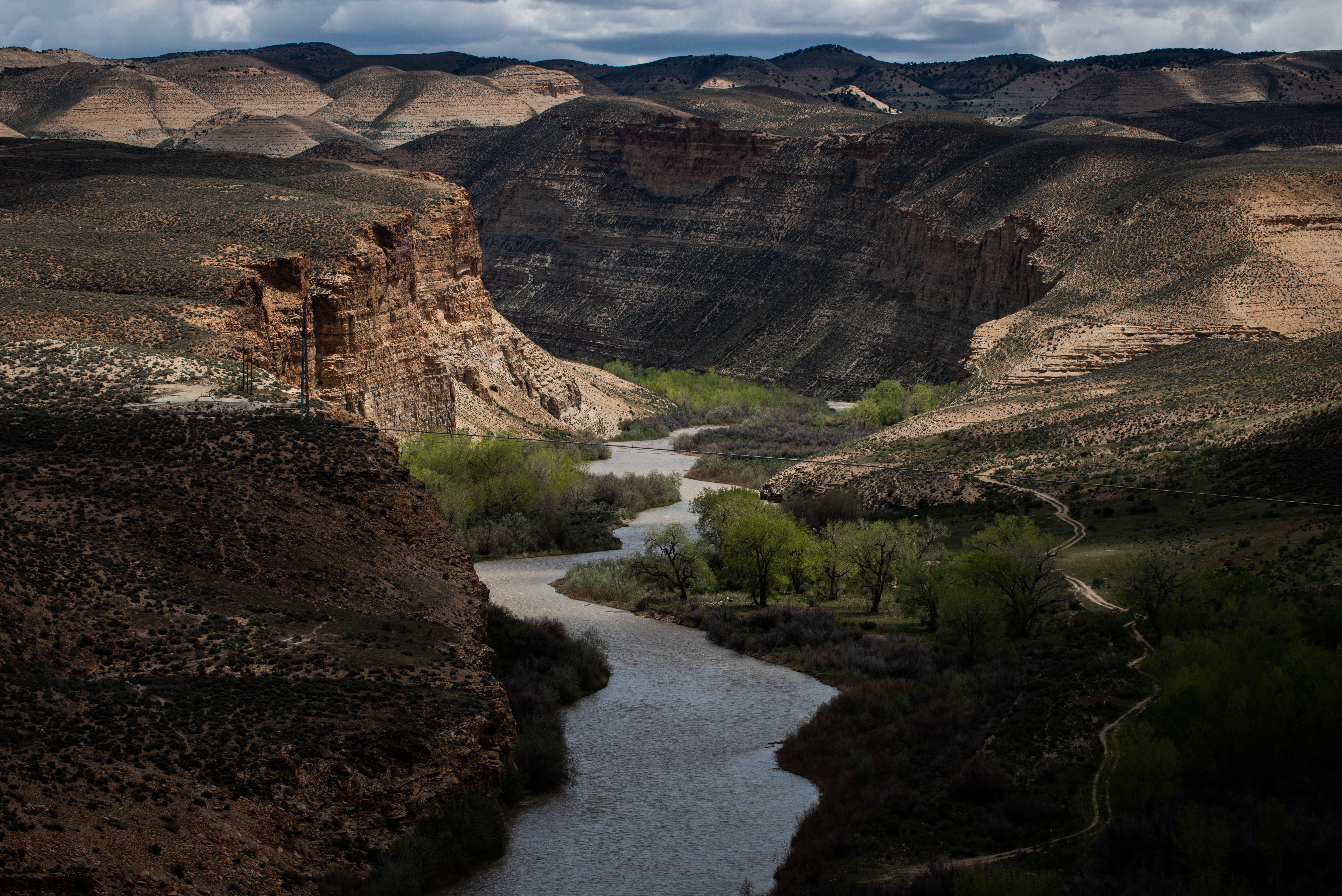
From the water, the White River canyon was a scene worthy of Ansel Adams. Swallows darted in and out of mud houses packed on the underside of the soaring sandstone cliffs. A lone elk wandered the hillside, while sheep noshed along the water, tended by a man on a horse striking an iconic Western pose up on the ridge. But then, as we drifted peacefully around a bend, the stench of oil and other volatile organic compounds engulfed our little flotilla of rubber rafts in an invisible cloud of toxic gasses, blotting out the scent of sagebrush that had followed us down the river for the past two days. Eventually, the reason for the headache-inducing fumes came into view, and it wasn’t the sheep.
Gas lines draped over the cliffs and crosshatched the swallow nests, serving as the most visible indication that high on the plateau above us lay the state of Utah’s most productive oil and gas fields. There are currently more than 13,000 active oil and gas wells in Eastern Utah’s Uinta Basin. Local environmentalists have dubbed this sparsely populated desert region “Mordor,” after J.R.R. Tolkien’s industrial hellscape. Hemmed in by high mountain ranges on three sides, the basin is home to only about 50,000 people stretched over 9,300 square miles. Yet it suffers Beijing-level air quality that frequently violates the Clean Air Act. “The place is completely decimated,” says Taylor McKinnon, the southwest director of the Center for Biological Diversity. “It’s one of the oil and gas sacrifice zones in the US.”
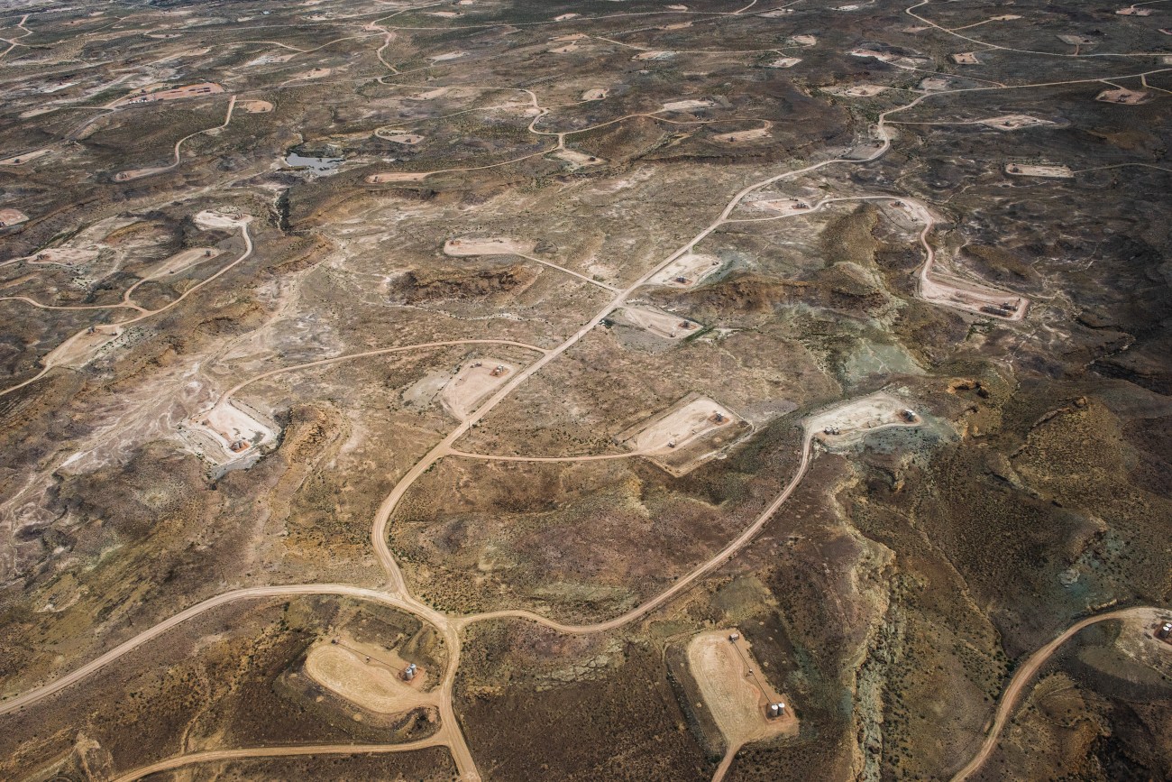
Fracking sites near the White River.
Russel Albert Daniels
Last year, I went down the White River with photographer Russel Albert Daniels to take a closer look at what’s happening in the Uinta Basin, where dystopian industrial development overshadows its critical ecological role as the watershed of the endangered Colorado River. Some 40 million people depend on the Colorado for water. But the West’s most important river is predicted to shrink up to 30 percent or more by mid-century because of rising temperatures caused, in part, by the very fossil fuels extracted from its Utah watershed. And while scientists warn that the planet needs to stop burning these fuels in the next decade to prevent ecological catastrophe, Utah’s political leaders are actively pushing to quadruple oil and gas production in the basin. And they’re getting a lot of help from the Biden Administration.
The federal government plays an unusually outsized role in the Uinta Basin. That’s because more than 70 percent of the land there is public, including Dinosaur National Monument, which starts on its eastern border. Much of the basin encompasses the Uintah and Ouray Reservation, home of the Ute tribe and more than half of the region’s oil wells. It’s also the habitat of a host of federally protected wildlife—endangered cacti and ancient fish, and the threatened greater sage grouse, a squat bird famous for its elaborate mating dance whose numbers have declined 40 percent since 2002 because of oil and gas drilling.
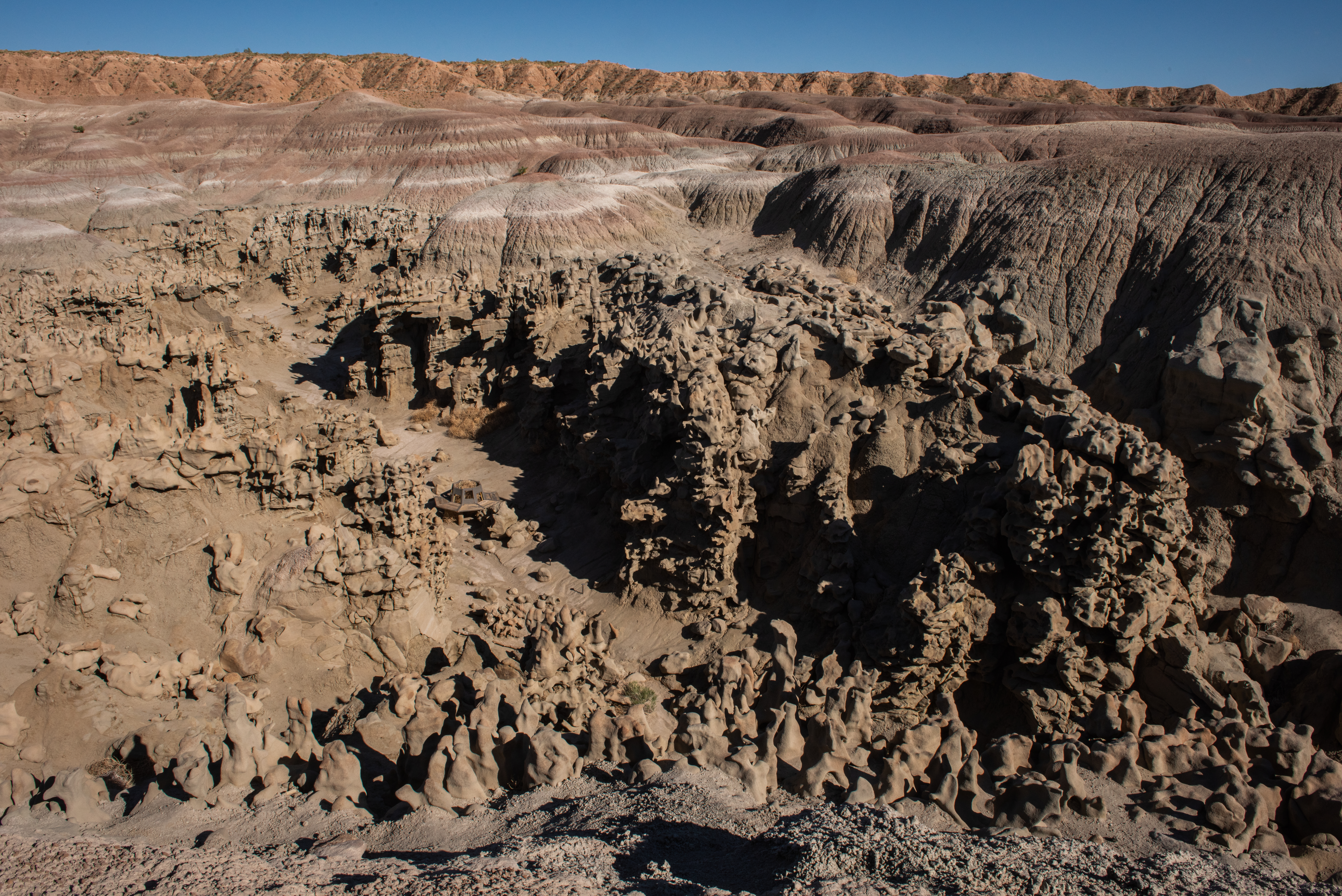
After taking office, Biden issued an executive order halting new oil and gas leasing on public lands as part of his campaign pledge to combat climate change. But in April last year, the administration restarted leasing. Seven months later, the US Bureau of Land Management announced plans to auction off nearly 9,000 acres in the basin for new drilling this year. At least one parcel on offer would further decimate the area around Fantasy Canyon, a funky made-for-Instagram outcropping of sandstone formations not far from the White River. Other parcels encompass the sensitive habitat of endangered plants and the greater sage grouse.
In the early aughts, drilling in the basin grew exponentially after the advent of fracking. At the peak, energy companies were seeking more than 2,000 permits a year for new oil and gas wells in Utah. But in 2015, energy prices crashed. In 2019, the last year before the pandemic, energy companies applied for only 263 drilling permits from the state.
But the Ukraine war has sparked a revival, says Landon Newell, a staff attorney at the Southern Utah Wilderness Alliance, which has fought fossil fuel projects along the river. Nearly 300 new wells were drilled last year, compared with 154 in 2019. Overall production levels are up significantly over pre-pandemic levels. Energy companies have already applied for nearly 500 drilling permits this year—at least 100 more than in all of 2022. If the current pace continues, Utah will approve more drilling permits in 2023 than it has in any single year for almost a decade, according to state data analyzed by Mother Jones.
More drilling is likely to come thanks to Biden’s signature infrastructure and climate legislation, the Inflation Reduction Act. The law, passed last August, bans any solar or wind development on public land unless the BLM auctions at least 2 million acres of its land for oil and gas drilling every year for the next decade. West Virginia Sen. Joe Manchin (D) demanded the measure in exchange for his vote to pass the bill, a Washington compromise whose impact will be felt acutely in the Uinta Basin. BLM expects the resulting new wells from this year’s auction to release nearly as many greenhouse gasses as 57,000 cars do in a year, an outcome that flies in the face of Biden’s climate pledge. Nonetheless, in an environmental assessment, the agency claims it has no choice but to approve the leases: “[C]ontinued oil and gas leasing is mandated by the Inflation Reduction Act for the expansion of renewable energy on Federal lands.”
“It’s a special kind of suicide to be continuing to use federal public lands to beget decades more of fossil fuel expansion at the same time we’re looking at the demise of the [Colorado] river just from the greenhouse emissions,” McKinnon says. The IRA, he notes, “basically holds renewable energy development hostage to oil and gas expansion.”
The moon was almost full on a clear evening in May last year when we pulled the boats onto the shore of the White River to pitch camp for the night. During the short float from the put-in at Bonanza to our first campsite, we saw wild turkeys, great blue herons, and geese. Ravens clustered high atop the rock walls rising up around us. Once on shore, we set up a “kitchen” and the “groover”—an old ammo can with a toilet seat on top—and then sat around the campfire watching the setting sun imbue the castle rocks with a gorgeous pink glow. I listened as our veteran guide, John Weisheit, spun jargon-filled yarns about floating the Green River’s iconic canyons like Desolation and Labyrinth. Before I met him in real life, I’d half-expected Weisheit to resemble Seldom Seen Smith, the salty Jack Mormon river runner in Edward Abbey’s novel, The Monkey Wrench Gang. The two share a hatred of the Glen Canyon dam, which Smith tried to blow up in the book. But in his wellies and floppy hat, Weisheit more resembled an absent-minded professor than a philandering eco-terrorist.
He frequently invoked Wallace Stegner, his favorite author, and regaled us with stories about meeting the late Interior Secretary Stewart Udall, who with urging from Stegner, helped create the Endangered Species Act. Weisheit never met Stegner, but he seems to have known just about every other big-name writer or activist in the southwest, including Katie Lee, the late Hollywood starlet who was photographed nude in Glen Canyon before it was flooded in 1964 to create Lake Powell. During our trip, the wiry, weathered guide occasionally emulated her by wading out into the water buck-naked.
Originally from Los Angeles, Weisheit has lived in Moab, Utah, for 37 of his 69 years. He used to spend 280 days a year on the Colorado River: seven months as a guide in Canyonlands National Park, and then two months taking scientists into the Grand Canyon. Those scientists warned him in 1992 that the Colorado River was in trouble from climate change, and he observed the changes first-hand. “I’m not a full-time guide anymore,” he told me later, “because I decided to do something about the heartache I got on every river trip I did.”
Weisheit then became a one-man environmental movement through his nonprofit Living Rivers. He is the plaintiff in dozens of lawsuits, all fighting oil and gas development or other threats to his beloved waterways. His connection to the Colorado runs deep. He married his wife Suzette on a sandbar in Canyonlands where the Green River meets the Colorado. Suzette, also a former river guide along for our float, had hiked to the headwaters of the Colorado and collected river water, while John got some from the Green, and then during their barefoot wedding ceremony, they poured the (sanitized) water into one glass and drank from it. In July last year after our trip, Weisheit officiated the Colorado wedding of our other two guides, river advocate Rica Fulton and environmental filmmaker Cody Perry, to whom he is clearly hoping to pass the torch one day.
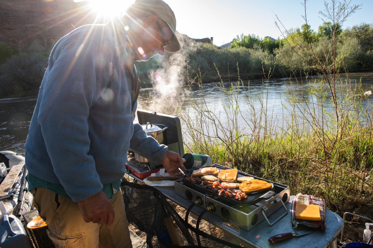
John Weisheit prepares breakfast on the White River.
Russel Albert Daniels
Pointing to the cliffs around us, Weisheit provided a campfire geology lesson. Millions of years ago, he explained, our spot on the river was the bottom of ancient Lake Uinta. All the organic matter that accumulated on the bottom of the lake account for the estimated three trillion barrels of oil shale in the massive geological marvel known as the Green River Formation that stretches into Colorado and Wyoming. In 2012, the US Government Accountability Office reported to Congress that if even half of the formation’s unconventional oil was recoverable, it would “be equal to the entire world’s proven oil reserves.” Smooth pieces of rainbow-colored shale lay all around us on the riverbank. Weisheit dipped one into the campfire and it ignited, smelling like asphalt.
Ute tribes, fur trappers, and early white settlers have known about the potential for oil in the Uinta Basin since the late 1800s, but it wasn’t until 1948 that the basin saw its first gusher. Today, the basin produces about 90,000 barrels a day of thick, waxy crude that is trucked to five refineries in Salt Lake City. Compared to the 5 million barrels of oil a day produced in the Permian basin in Texas and New Mexico, the Uinta Basin output is pretty small potatoes—less than 2 percent of the country’s total. Which makes its threat to western waterways vastly out of proportion to its national economic benefits.
We spent that first night on the river sleeping under the stars, listening to sheep bleating and the riverbank calving—the eerie sound of huge walls of earth collapsing into the water, erosion in real time. After a hearty breakfast the next morning, we continued our 30-mile journey down the White. Three-leaf sumac bushes painted the riverbank red. Sego lilies, the state flower, peeked out of the brush. An osprey hunted along the water ahead of us, along with a turkey hunter riding a horse way up on a ridge—the only other human in sight.
Weisheit pointed out a stand of increasingly rare cottonwoods listing precariously on the riverbank, which he estimated dated back to the 1920s. The trees owe their survival here to the way the White River meanders on its way to meet the Green. Historically, Western desert rivers followed a natural cycle in which spring snowmelt produced monsoon-like floods and then as the year wore on, the rivers would endure periods of near-drought. That cycle brought large amounts of sediment down the river, which provided rich environments for cottonwood galleries and ancient native fish like the now-endangered razorback sucker that live nowhere else in the world.
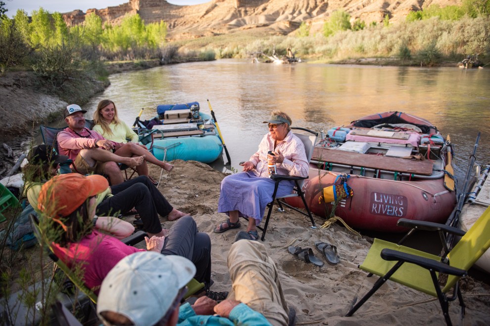
(Left to right) Rita Fulton, Cody Perry, Benjamin Kraushaar, Stephaine Mencimer, John Weisheit and Susette Weisheit (center) share stories on the bank of the White River.
Russel Albert Daniels
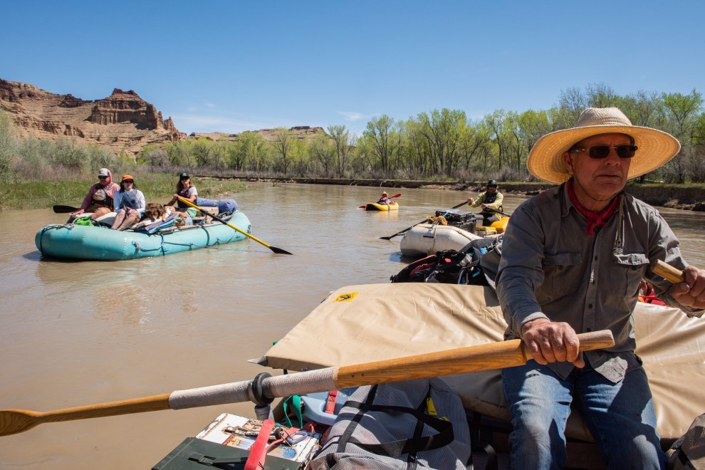
John Weisheit (right) and our rafting flotilla heading west on the White River.
Russel Albert Daniels
That cycle mostly came to an end in the 20th century with the construction of massive dams on the Colorado and the Green River—the Colorado’s largest tributary, which dominates the Uinta Basin. Today, those rivers no longer really flood. But the White remains mostly undammed. When we set off last May, its high waters were muddy brown and full of silt—a sign of health—but by August, Weisheit says the water level in the White can fall too low to get a boat in. Thanks to that natural flow, it still has some natural stocks of the ancient fish that have all but disappeared in the Colorado.
That’s one reason environmentalists have spent decades trying to protect this river. But the Uinta Basin is a hard place to be an environmentalist. In 1999, BLM finally proposed designating a section of the White as a wilderness study area because of its roadless areas, natural beauty, and opportunities for solitude. The proposal, which would have restricted oil and gas development around some sections of the river, set off a storm of protests in the Uinta basin that are a harbinger of the local reactions to future efforts to transition away from fossil fuels.
One Friday night in May 1999, local officials “bladed and graded” two new dirt roads to the river in an area BLM had designated off-limits to motorized vehicles. In an audacious and illegal move, the county then insisted that the roads were important and regularly maintained thoroughfares that couldn’t possibly qualify as wilderness. Rep. Chris Cannon (R-Utah) flew in by helicopter two weeks later to join 300 people who drove off-road vehicles on the new roads to protest the wilderness designation. Canon himself drove a county vehicle past a “no motorized vehicles” sign. The proposal stalled, and in 2003, Interior Secretary Gale Norton inked an agreement with the state of Utah preventing BLM from designating any more wilderness study areas, and that was the end of that.
Will Durant, a longtime Indian Health Service doctor, was president of the Uinta Mountain Club, which had pushed for the White River wilderness designation. After the road blading incident, he gave up the fight, as did many local environmentalists. “If a congressman can come in with county commissioners and like-minded folks and violate a land management regulation,” he told me sadly, “then what can I or anyone do to save the White River Canyon?”
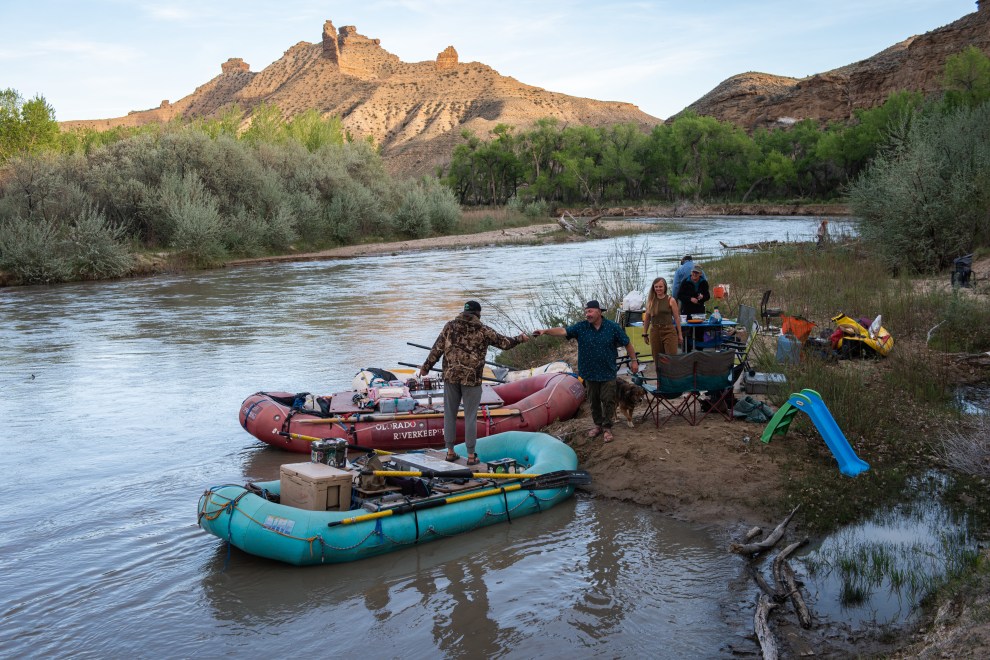
Last light at camp on the White River.
Russel Albert Daniels
On our second night on the river, we set up camp at Atchee Wash, where county officials had graded the new road they claimed in 1999 was such an important thoroughfare. There was no sign of human activity. But there was a trail sign for Goblin City, a geological oddity documented in 1871 by three men on John Wesley Powell’s second Colorado River expedition. They’d camped here, too. In his journals, 17-year-old artist Frederick Dellenbaugh described the dramatic outcrop of rock ridges, towers, and spires on the cliff above our campsite as “having a striking suggestion of a town.” Even a historic place like this has been threatened by fossil fuel development. In 2007, a natural gas company planned to drill more than 60 wells around Goblin City, using water pumped from the White River. As with so many environmental victories here, the site was saved only by a well-timed crash in energy prices.
I threw my sleeping bag on the ground near the trail sign in a gallery of cottonwood trees, whose early green shoots were just emerging, and conked out in the cool night air. But at 1 a.m., I awoke to the sound of bells. I flipped on my headlamp and found myself face to face with a herd of demon sheep, whose eyes glowed red in the moonlight. I quickly relocated to a sandbar.
In the morning, we loaded up the boats and headed towards our final destination—a boat ramp in a place fittingly called Enron. As we got closer, the air became thicker with industrial fumes redolent of rotten eggs. “You don’t want to camp here,” Fulton noted. And then we saw the first of many water trucks whose drivers had set up pumps on the gravel and simply thrown a hose into the river. The trucks would deliver the river water to a well where it would be injected into the ground to force out the oil or gas, the process known as fracking. One well can require hundreds of water truck trips.
It’s a shockingly primitive system. Later, I asked the Utah Department of Natural Resources Division of Oil, Gas, and Mining how the state regulates the water pumped out of the river. A spokeswoman told me in an email that if I saw a truck withdrawing water from the river, it obviously had a permit, which seemed like a remarkably naive approach for a state in the midst of a two-decade-long megadrought. When I asked how much water oil and gas drilling used in the basin, the DNR spokeswoman sent me a YouTube video of the Utah Petroleum Association briefing the division.
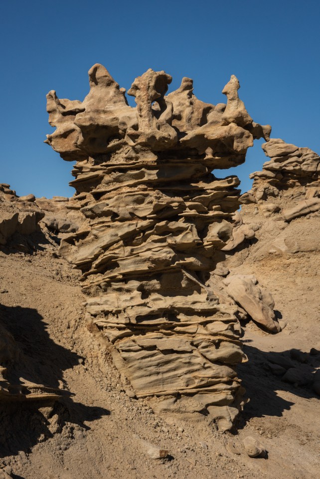
Hoodoos at Fantasy Canyon close to the White River.
Russel Albert Daniels
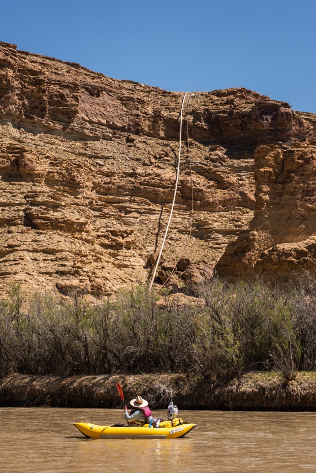
Susette Weisheit passes by a pipeline dangling off of a cliff along the White River.
Russel Albert Daniels
In the video, Lauren Brown, vice president for environment and regulatory at XCL Resources, one of the biggest energy companies in the basin, said that a typical two-rig drilling operation on the company’s Utah acreage uses about 27 million barrels of water a year. That’s 850,000,000 gallons or enough to supply annual domestic water to more than 28,000 Americans. But XCL is only one company. The state couldn’t tell me how much water the oil and gas industry collectively uses in the basin.
“Water use reporting is all self-reported,” Andrew Dutson told me. He is the regional engineer for the Utah Division of Water Rights in Vernal, the largest town in the Uinta Basin. “The state doesn’t check it. It doesn’t have the ability to check.” The Green and White Rivers, whose flows are included in the state’s Colorado River allocations, “are completely unmonitored,” he said, even though a single frac well can use “a huge amount of water.” I asked him what happened in the rare event that someone got caught cheating or using water it didn’t have a permit for. In theory, the division could issue a fine, he said. But it never had.
The smell of VOCs got worse as we got closer to Enron. Black puddles of oil seeped out of the ground along the river, which, Weisheit explained, sometimes occurs naturally and contributes to the odor. But then we encountered a part of the embankment that had been bulldozed, leaving behind the residue of a distinctly unnatural oil spill that had been half-heartedly remediated. Oil spills are a regular occurrence in the Uinta Basin. State environmental incident reports show mostly small ones, affecting the soil and vegetation when wellheads blow out, pipelines rupture, or a tanker truck crashes and leaks. There have been 25 spills in the basin this year already. John Mackey, the director of the Utah Division of Water Quality, says that even though those spills are on soil, they are still a concern for water quality because while they might not directly end up in a stream, “they will make it there eventually, either through the groundwater or via stormwater drainages into surface waters.”
The risk of a significant spill in a critical Colorado River tributary in Utah isn’t a hypothetical. As Weisheit told a local paper in 2014, “Anyone who depends upon the Colorado River should look upstream to Utah… It’s not ‘if,’ but ‘when.’” That year, an oil well a few hours south of us had blown out. For more than 24 hours it sent 100 gallons an hour of crude oil and toxic produced water rushing towards the Green River. Despite efforts to contain the spill, some of it made its way into the river during a thunderstorm. Campers downstream documented the oil slicks.
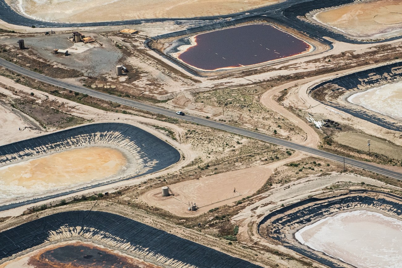
Fracking waste water pools on Glen Bench Road above the White River.
Russel Albert Daniels
Stan Olmstead spent 20 years working as a natural resource specialist in BLM’s Vernal field office in the Uinta Basin, the agency’s busiest oil and gas permitting office. While there, he raised concerns about the large number of oil and gas wells in the basin that had been abandoned, threatening to leak methane and other pollutants. After retiring, in 2015, he crunched public records to determine that there were more than 500 abandoned wells in the basin, some dating back to the 1960s.
But Olmstead says the bigger contamination threat to the rivers came not from oil but from water. Energy companies inject massive amounts of water into the ground to widen cracks in the rock to access oil and gas. Horizontal wells can run a mile wide. The water comes back out along with the oil or gas as well as with more groundwater—and a bunch of salts, heavy metals, and toxic chemicals. That noxious fracking byproduct is euphemistically known as “produced water.” XCL’s Lauren Brown told the Utah Division of Oil, Gas, and Mining in September that her company produces about 50,000 barrels of such water a day—more than 1.5 million gallons—in its operation in the basin, which she anticipated would double in the next year. Reports from the state show that in 2022, drilling in the Uinta Basin produced more than 3 billion gallons of wastewater.
Energy companies dispose of most of that produced water by injecting it back into the ground, a process that has caused earthquakes in other states. They also truck a significant amount of the toxic water to evaporation ponds—shallow, football-field-sized pits lined with rubber. As the freshwater evaporates, the toxins concentrate in the bottom or around the edges and blow around in the wind until the mess is taken for hazmat disposal. The Uinta Basin is littered with such facilities, with clusters of them all along the White River and on tribal land.
Before we embarked on this river trip, Daniels and I had visited an evaporation pond about a mile from the White River boat ramp in Bonanza. The water shimmered an unnatural, industrial orange and off-gassed something fierce enough to blur our vision. Birds flitted overhead—a disturbing sight given that evaporation ponds kill between 500,000 and 1 million birds every year in the US. Choking on the fumes, we made a quick retreat.
While the evaporation ponds are unspeakably gross, every environmentalist I talked to in Utah had heard credible reports over the years of something worse: companies dumping produced water directly into the rivers. “I’d go out in the field, and I’d see water trails on the road,” Olmstead told me. “I could never witness how it got there. All I could think was that in the middle of the night, someone picked up brine water and then opened the spigot and let it out on the road…You could never prove it was going somewhere it shouldn’t be.”
The Utah Division of Oil, Gas, and Mining took issue with the suggestion that such illegal dumping might occur in the basin. The agency “has never received allegations of operators dumping produced water into Utah rivers,” a spokesperson told me in an email. “It is a claim our office takes very seriously. Six division field inspectors inspect disposal and underground injection facilities and communicate regularly with operators to ensure compliance with state rules.”
Yet I found dozens of reports in the state’s database going back more than a decade indicating that, at the very least, produced water in the basin wasn’t being disposed of properly and was contaminating the soil, farmers’ stock ponds, or local streams. In 2006, at least 100 barrels of produced water from a drilling rig flowed into Starvation Reservoir on the basin’s Strawberry River. In 2008, an anonymous caller said a water trucking company was using a backhoe to dig trenches on its property and dumping in produced water that ran into a dry wash that drained into a creek. In 2011, an inspector reported that people near the town of Jensen, “claim trucks come in at night and dump production water into an old gravel pit area. It is obvious that dumping is going on. It is not in a waterway, but has created its own pond.” Just this month, according to a report, “a water hauler unloaded their water tank and dumped an estimated 130 barrels of produced water which went into a dry drainage ditch for about one-tenth of a mile” on tribal land near Ouray.
In 2007, while Olmstead was at BLM, some birdwatchers reported a huge plume of petroleum-smelling foam going down the Green River near Ouray, where the Fish and Wildlife Service maintains the hatchery in the basin for endangered Colorado River fish. The state waited eight days to investigate. By then, the foam was gone. Drilling fluid that had recently leaked from a gas well seemed a likely culprit. “There’s detergents in fracking solution,” Olmstead explained. But he says BLM officially blamed the foam on natural organic material. Longtime river runners who had been on that water for decades didn’t buy it. “This is obviously, probably, a very wanton kind of act,” the late, legendary Utah river guide Herm Hoops told a local news outlet. “And people didn’t care about what they did, just walked away from it because it went somewhere else.”
“There are undoubtedly some spills that occur and go unnoticed and get left behind, unfortunately,” says the Department of Water Quality’s Mackey, adding that all the reported spills get cleaned up. “We get reports, as you’ve heard, of incidents—boaters will see foam on the river. But chemically, biologically, the Green River is healthy.”
The water used in oil and gas drilling doesn’t get enough attention because it’s a relatively small amount compared with something like alfalfa farming, says Jon Holst, a wildlife and energy adviser at the Theodore Roosevelt Conservation Partnership who spent several years working for an energy company in the Uinta Basin. But Holst says that water used for agriculture at least gets recycled. That’s not the case with oil and gas production.
On our last day, we stopped for a picnic of chips and sandwiches on a hot, gravely sandbar in a desolate part of the river. As we ate, we noticed a killdeer feverishly flapping its wings and twirling around in circles. Suzette Weisheit, our resident ornithology expert, realized that the little bird was desperately trying to distract us from a nest somewhere among the rocks. A quick survey revealed four tiny eggs indistinguishable from the pile of stones carefully arranged around them. We scrambled to throw everything in the boats and leave her in peace.
Back on the water, we lamented our intrusion into the little plover’s home. “It just shows you that one person’s badland is someone else’s habitat,” John Weisheit observed. The same could be said for the entire Uinta Basin. Outside of the Green and White Rivers, it looks lifeless—easily expendable. As with the sandbar, you have to look a little harder to appreciate the importance of the ecosystem.
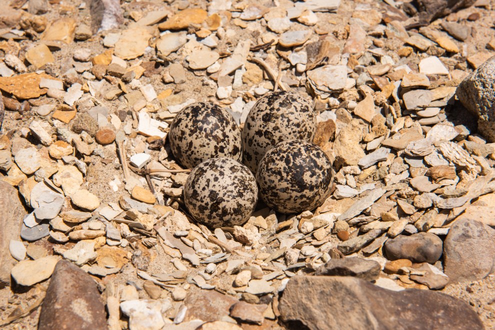
Killdeer eggs along the White River banks.
Russel Albert Daniels
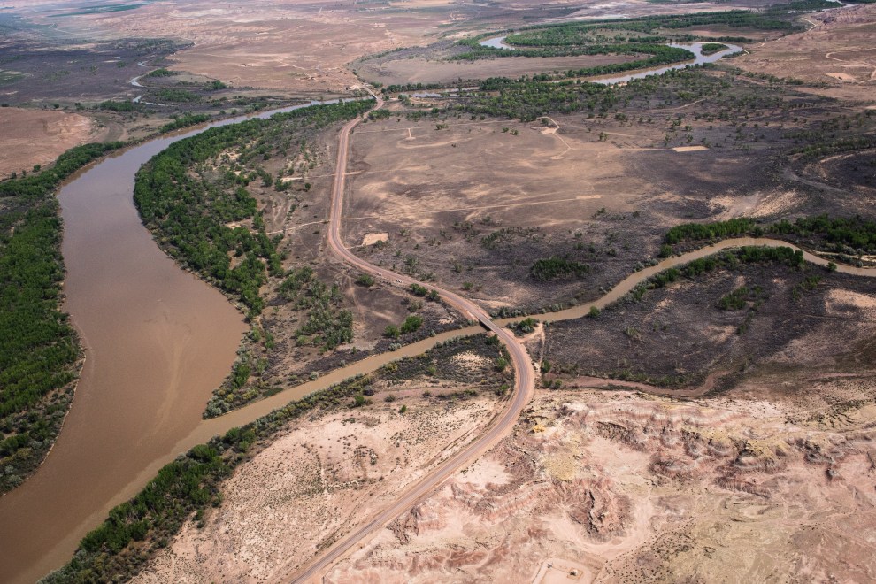
Service roads to gas wells along the White River near the confluence with the Green River.
Russel Albert Daniels
The high spirits we had when we left Bonanza faded as the air quality got worse. Our jovial crew of sunburned rafters was subdued. Even Harper the river dog was moping. We floated quietly the final few miles to Enron, the last place to pull out before crossing into tribal land. After unloading the boats, Daniels and I bid farewell to our hosts and headed across the Bonanza bridge, high above the White River canyon, where we could enjoy the spectacular view—without the fumes.
This article was supported by The Water Desk, an independent journalism initiative based at the University of Colorado Boulder’s Center for Environmental Journalism. Aerial support provided by LightHawk. Data visualization by Ryan Little.
