Columbus and his ocean-cruising colleagues were great at showing up late to the party and swaggering around like they owned the place, but every now and then, European explorers did bump into uncharted and uninhabited lands. Yale geography professor Bill Rankin has mapped these spots, mostly “diminutive islands that no human had ever seen before, along with extravagant amounts of ice and snow.” Today, just 0.05 percent of the world population, or 3.6 million people, live in these places.
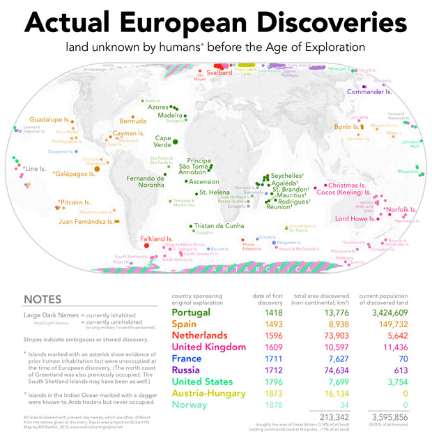
These islands make up roughly the area of Great Britain, or 0.14 percent of the land on Earth. But if you include the frozen expanses of land at the poles, the conquistadors can claim another 11 percent!
The map also reveals some interesting 16th-century geopolitics. The kaleidoscopes of color along the edges of the map show the spoils of whaling wars, Rankin writes, which led to a “free-for-all” land grab. The middle of the map is dominated by Portugal (green) and Spain (brown); Rankin would have readers recall the 1494 Treaty of Tordesillas, which divvied up discoveries between the two imperial powers. Today, the population living on land (actually) discovered by Portuguese explorers comes to a whopping 3.4 million, far out performing Spain, with its measly 150,000. Vamos Portugal!
